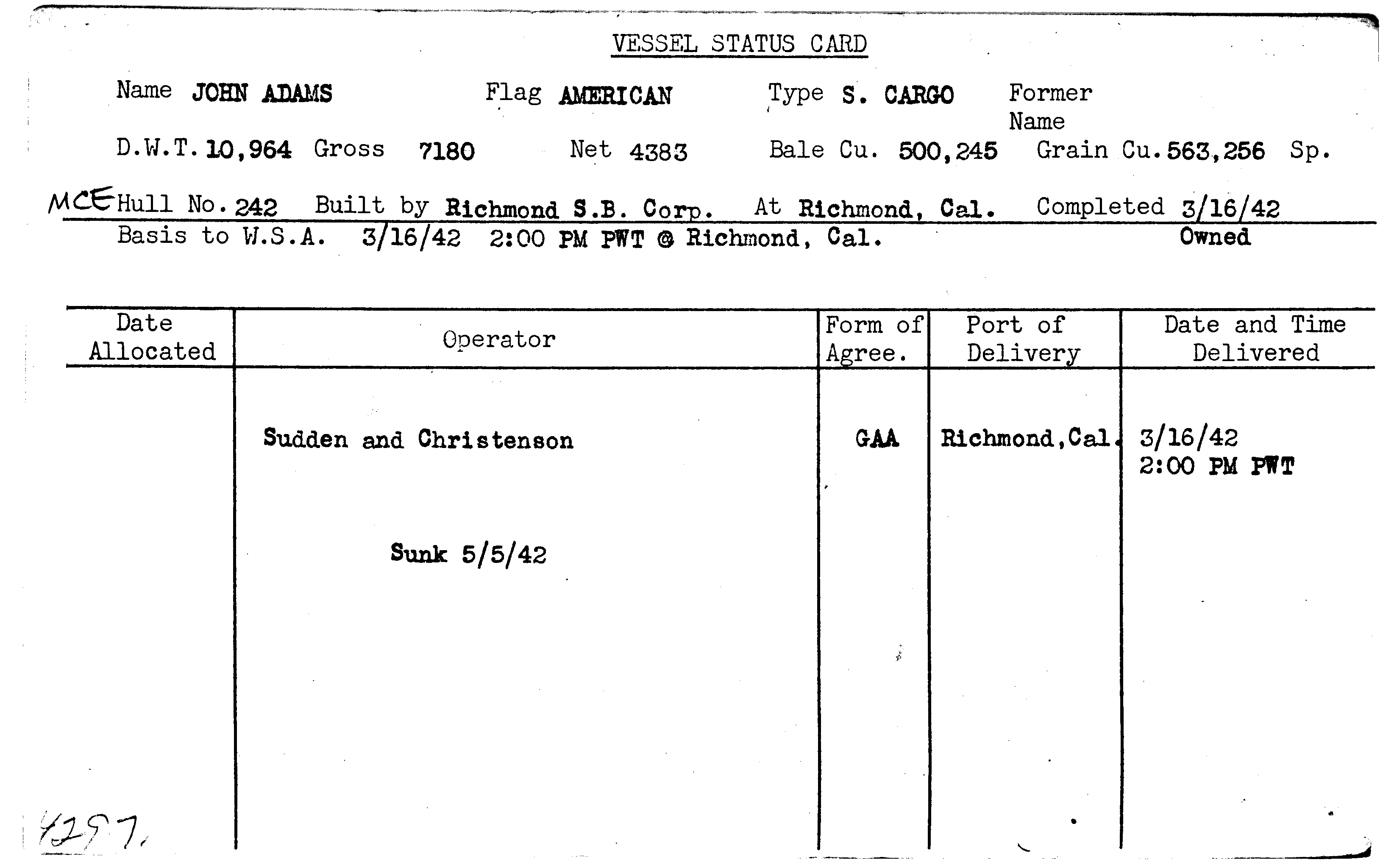
JOHN ADAMS

Year Built
1942
Official Number
--
Shipyard
Permanente Metals Corporation
General Type
General Cargo
Specific Type
Break Bulk
MARAD Type
EC2-S-C1
Ship Length
441.50 feet
Beam
57.00 feet
Mast Height
--
Net Tons
4383.00 tons
Gross Tons
7180.00 tons
Cargo Capacity
500245.00 square feet
Draft, Summer
--
Draft, Lightweight
--
Displacement, Summer
--
Displacement, Lightweight
--
Immersion, Summer
--
Immersion, Lightweight
--
Fate
Sunk - Torpedo
Mission
| Mission Name |
|---|
| World War II |
Historical Documents
| Name | Download |
|---|---|
| SYSTEM UPLOAD |
|
| SYSTEM UPLOAD |
|
Milestones
| No events for this vessel |
|---|
Ship Imagery
No images for this vessel
Status Cards
Documents
| Date | Type | Name | Download | |
|---|---|---|---|---|
| (No Date) | JOHN ADAMS.pdf |
|
||
| (No Date) | Historical | SYSTEM UPLOAD |
|
|
| (No Date) | Historical | SYSTEM UPLOAD |
|
Plans
No documents for this vessel
Shipwreck Information
Vessel Information
Owner
U.S. Maritime Commission
Operator
Sudden & Christenson
Operator Agreement
General Agent Agreement
Flag State
United States
Incident Information
Incident Date
May 05, 1942
Use at Loss
Cargo Transportation
Cause
Sunk - Torpedo
Cause Comments
Torpedoed by Japanese submarine I-21 while en route from Noumea, New Caledonia, to Brisbane, Australia.
Conflict
World War II
Location of Incident
Pacific Ocean
Accuracy of Incident Location
Historic 1
Lat/Long
23° 11' S., 165° 08' E.
Incident Location Comments
Approximately 85 miles from Amadee Lighthouse, New Caledonia
Lives Lost
--

